Outer Banks Directions
Chart your course
The Outer Banks is as far east as you can go without getting wet. With that simple truth in your back pocket, locate the direction you're coming from below and read our easy-to-follow instructions. They're guaranteed to alleviate the need to stop and ask.
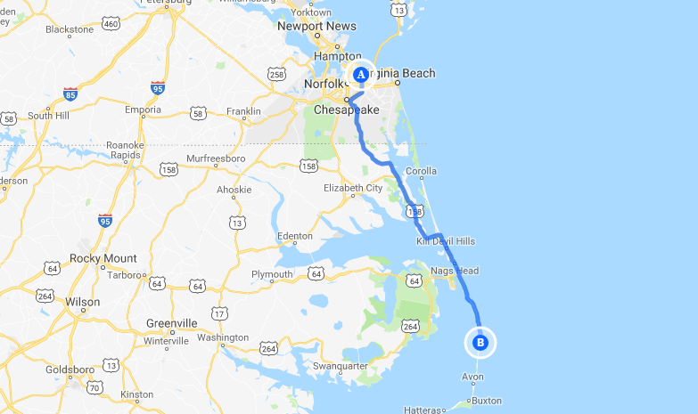
From Norfolk International Airport
- Start out going Southwest.
- Turn RIGHT toward I-64/Airport Exit.
- Turn LEFT onto NORVIEW AVE.
- Merge onto I-64/HAMPTON ROADS BELT toward VA BEACH/CHESAPEAKE.
- Merge onto I-464 S/US-17 S/MARTIN LUTHER KING JR MEMORIAL HWY via EXIT 291B toward VA-104 S/ELIZABETH CITY/US-17 S/DOMINION BLVD/VA-168 S.
- Merge onto VA-168 S via the exit on the LEFT toward NAGS HEAD/MANTEO (Portions toll). VA-168 S becomes US-158 S.
From the North
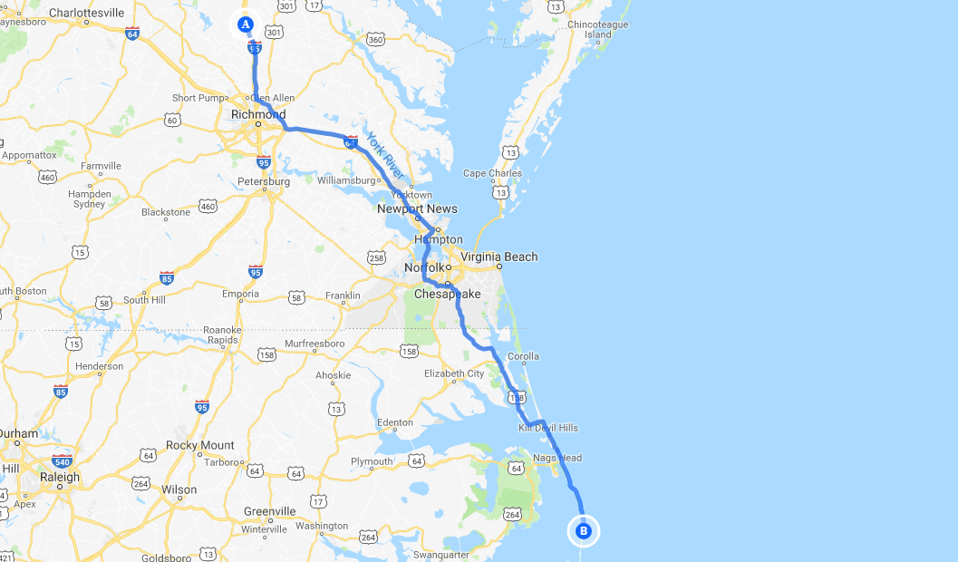
- Follow I-95 South to Richmond, Va.
- Take I-64 East toward Norfolk/Virginia Beach, Va.
- Take I-64 or I-664 to Chesapeake, Va.
- From I-64, take Exit 291B to Route 168, the Chesapeake Expressway. *Once in North Carolina, Route 168 turns into US-158 East. (Avoiding Toll Charges on Route 168 (Chesapeake Expressway), take exit 8B off of Route 168 South (Hillcrest Parkway Exit), turn right at second traffic light (near Wawa) on to Battlefield Blvd. (Route 168 South Business).
- Follow this road to The Outer Banks. *Chesapeake Expressway is a toll-road with new rates that took effect May 1, 2011. EZPass and SmartTag accepted.
Alternate Approach From North
- From Virginia's Eastern Shore across the Chesapeake Bay Bridge Tunnel (Route 13), follow Route 13, Northampton Boulevard, to I-64 East (to Chesapeake), take Exit 291B to Route 168, the Chesapeake Expressway. *Once in North Carolina, Route 168 turns into US-158 East. Follow this road to The Outer Banks. *Chesapeake Expressway is a toll-road with new rates that took effect May 1, 2011. EZPass and SmartTag accepted.
- For up-to-date road construction and traffic congestion while traveling in Virginia, visit 511virginia.org
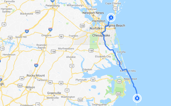
A Scenic Drive From North
- Get off I-64 at Hampton, Va.
- Go South on I-664 through Monitor-Merrimack Memorial Bridge-Tunnel.
- Take I-64 toward Norfolk/Virginia Beach; then go south on US-17 at Deep Creek, Va. to South Mills, NC.
- Follow NC-343 south to US-158 South to The Outer Banks.
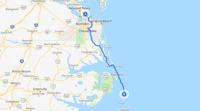
From The West
- Via I-95 or I-85 into North Carolina. Take US-64 East toward Rocky Mount.
- Follow US-64 East through Williamston and Plymouth, NC.
- From Plymouth, NC keep going east to Roanoke Island and The Outer Banks.
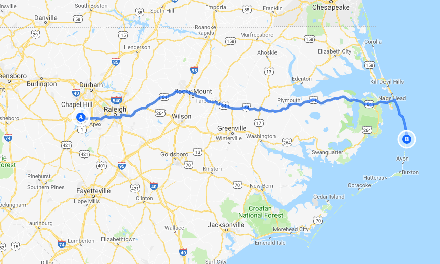
From The South
- Take I-95 to Rocky Mount, NC.
- Take US-64 East toward Rocky Mount.
- Follow US-64 east through Williamston and Plymouth, NC.
- From Plymouth, NC keep going east to Roanoke Island and The Outer Banks.
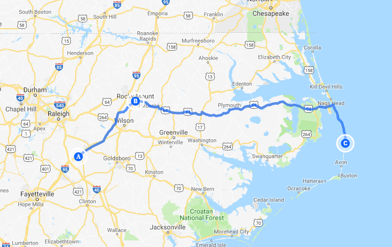
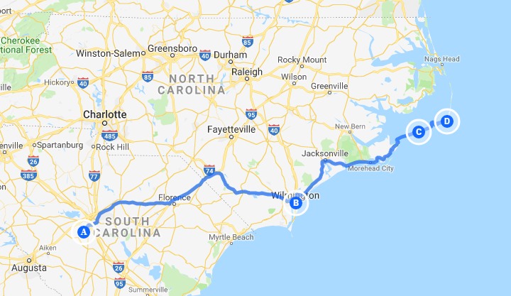
A Scenic Drive From South
- Take US-17N from South Carolina to Wilmington, NC.
- From US-17N take State Route 24 east until it runs into US-70 (before Morehead City, NC).
- Follow US-70 North from Morehead City to State Route 12 and the Cedar Island Ferry.
- Take the toll ferry to Ocracoke Island.
- Then take State Route 12 north to the Hatteras Island Ferry.
Driving Distances
| City/State | Approximate Mileage |
|---|---|
| Asheville, NC | 460 mi. |
| Atlanta, GA | 607 mi. |
| Baltimore, MD | 315 mi. |
| Boston, MA | 717 mi. |
| Charleston, SC | 450 mi. |
| Charlotte, NC | 359 mi. |
| Cincinnati, OH | 739 mi. |
| Cleveland, OH | 632 mi. |
| Columbus, OH | 670 mi. |
| Fayetteville, NC | 242 mi. |
| Greensboro, NC | 282 mi. |
| Greenville, NC | 150 mi. |
| Jacksonville, FL | 624 mi. |
| Montreal, Quebec | 780 mi. |
| Myrtle Beach, SC | 321 mi. |
| Nashville, TN | 732 mi. |
| Newark, NJ | 482 mi. |
| New York City, NY | 503 mi. |
| Norfolk, VA | 90 mi. |
| Philadelphia, PA | 413 mi. |
| Pittsburgh, PA | 505 mi. |
| Raleigh, NC | 192 mi. |
| Richmond, VA | 169 mi. |
| Rocky Mount, NC | 154 mi. |
| Savannah, GA | 492 mi. |
| Toronto, Ontario | 827 mi. |
| Washington, DC | 269 mi. |
| Wilmington, NC | 251 mi. |
Dynamic Variation:

